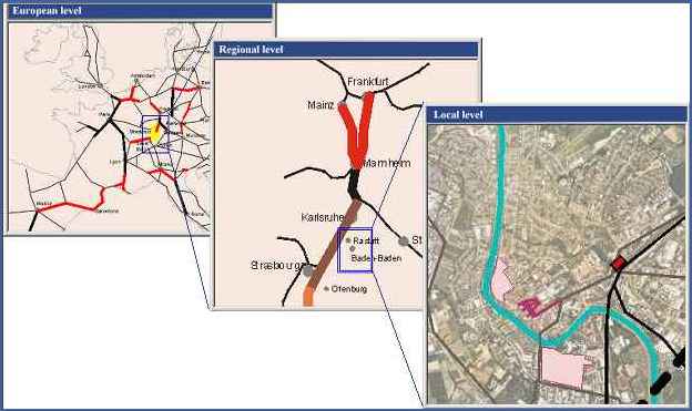
The Upper Rhine as a traffic corridor, plays a major role in three different levels:
* On the European level it is a central European north-south axis for transit and the point of departure for the Swiss Alps crossing
* On the national level (France, Swiss, Germany, with Netherlands and Italy at the very edges) it is an interstate traffic corridor that has national interests.
* On the regional level it is an axis for local traffic, where regional railways are organized in another way than national railways.
Consequently, different countries and regions have diverse and competitive aims regarding this corridor, even when the results are disadvantageous for all participants.
Another example is the German part of the Rhine and Upper Rhine valley. On the segment Cologne-Frankfort, upgrading the railway is expected to result in a shorter travel-time and a higher capacity. Thus, this part as an important national transit corridor has higher priority for the operator, while in the southern part (Offenburg-Basel) presents less pressure, and hence less priority. However, on a longer term, consequences might be remarked in form of a lack of capacity, especially for the regional traffic when the Swiss NEAT-projects are realized in 2008/2012. Using this overview the user can point out, that problems can only be solved by understanding the planning process as a teamwork of different actors, respecting their different interests. A balanced solution with a win-win-situation should be the result of complex planning situations, assisted by Internet based planning instruments.
1. The Navigation Bar: Using this navigation bar the user can navigate between different components of the case study.
2. The Map Area: In this area different maps are shown according to the current component that is selected from the navigation bar.
3. The Text Area: Is a different frame where explanatory text about the current components is shown.
4. The Information Area: In this area some information about the current layer is shown.
5. The Legend Area: In this area a list of layers in the current level are shown. The user can use this list to turn layers on and off according to his convenience. On turning a layer on, some information about this layer will be shown in the information area.
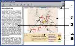
The User Interface
The second component of the platform is the spatial ventures overview. Here, ventures that have regional importance are included. These activities were classified into different classes: projects, problems, potentials and issues. Later on, other classes were included where important information exists, for example documents and map and images. The platform could include different background, satellite images or aerial photos. This background maps are used to create the spatial context of the region. Over these maps different elements in the overview are illustrated either in abstract form as symbols or in detailed form that presents the physical form of an element. The overview starts from a general and abstract level and gives the possibility to go on details regarding a specific sub region or a specific element. This hierarchy of organizing the overview contents facilitates including large amount of elements and information. At the same time the user is not lost in details that are not very important for his purposes in a specific time frame, but may be important later. The modular structure of the overview allows combining different elements and graphics together to concentrate on a specific issue or a specific spatial context.
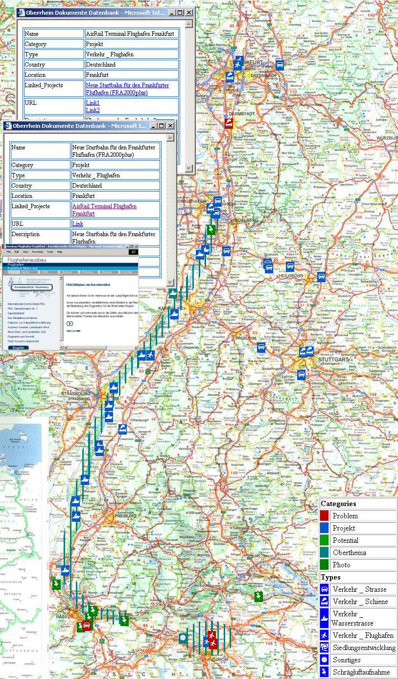
· Where are the (inter-)related projects for the Upper Rhine Valley (within or without the region itself)?
· When could/will these projects be realized and what are the consequences when the timetable is not up to date? What kind of level is reached for the legal bounds?
· What are the resources of these activities? How much do they cost and how many people are working on them?
· Who are the involved actors? What kind of organizations (public and private) are "playing their games" and what are their interests?