Globalisation impacts in agglomeration economies in northern Peru – time-space conditionings – Trujillo as a possible floating node
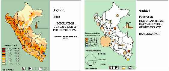
Peru has various comparative advantages, as it is an Amazon country with a strategic coastal location on a potential route of the Pacific great commercial exchanges. Its many mineral resources, arable land and exceptional climatic and ecological diversity are at the core of its basically permanent character as a raw material exporting country in the global occidental economy. But unequal development as well as disparities within the country, together with the slow pace at which it has assimilated technological advances in every socio-economic area, makes Peru a poor underdeveloped country.
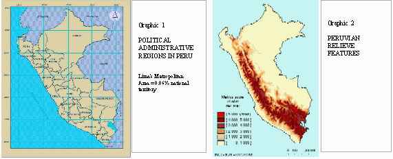
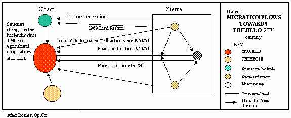
The 24 political-administrative Peruvian departments are distributed along the occidental coastal desert fringe, the sierra or Andean highlands, and the Amazon oriental plains. The country has a rapidly concentrating urbanisation process. Public services such as telecommunications and those that support productive and commercial activities, which use advanced technology, are located only in some of its largest cities.
Centralisation is one of Peru’s political and economic spatial characteristics. Lima is Peru’s capital city, generates 45% of its GDP while concentrating more than 55% of its capital stock(i). Nearly 40,3% of Peru’s urban population live in Lima, which amounts to 29,1% of the total population and 35%of the working force(ii). Around 82% of the Peruvian commercial bank savings and 83% of its loans take place there(iii).
Since the Spanish foundation of Lima (1513), each Peruvian government has encouraged this accumulative process. Nowadays 84% of the current income is generated in Lima where expenditures decisions on the 95% of the public budget are made – of this, 59% is used in Lima-(iv). Unemployment, underemployment and sanitary problems, which result in high poverty levels and low living standards, prevent Lima from being considered developed yet. Nevertheless its social and political advantages, urbanisation and external economies could launch Lima’s sustainable urban development. Therefore centralist-oriented politics have to be casted off to enable cities like Trujillo to benefit from the possibilities that globalisation offers.
Peru’s commercial exchange with the rest of the world
In order to be considered nowadays as a global city, a financial centre in a global scale, or as an entrepreneur cosmopolitan node like Hong Kong, cities have to place themselves on the virtual finance and commercial integration networks as well as to be a transport network node. A way to achieve this bet is to work on its main market-attractive features. That is why cities are seeking for elements that will satisfy profit expectations and products that can be differentiated because of their originality, excellence or the fact that they can help to build an economic cluster. Moreover, the clue seems to be in its divulgation’s speed and strength in a planetary scope and finding the proper window shops to arrive at its objective-receptor.
On the other hand, the dynamics triggered by the technological apogee in the scientific and technological world nodes and its repercussion in its national economic activities are increasingly excluding the other economic areas, the developing countries. Even more, the productive market of the factors that are considered nowadays important, is imperfect in Peru. Access to information, knowledge and technology is not uniform at all.
As a poor country its incorporation to the globalised world is in its initial stages and has many disadvantages. Its main exports are fishmeal, copper, gold, zinc, cotton, coffee, asparagus, textiles and crude oil. This conditions the GDP structure, which, by the year 2000, reached US$ 65 000 million(v), a relatively low when compared to other Latin-American countries, such as Argentina, Chile, Mexico or Brazil (US$ 295 000, 342 000 and 710 000 million respectively)(vi).
|
GDP STRUCTURE - ECONOMIC BROAD SECTORS – Year 2000(vii) |
||
|
PrimarY |
13,5% |
|
|
SecOndarY |
26,9% |
Primary products processing is included. |
|
TerciarY |
59,6% |
|
This productive structure affects the negative commercial balance and originates losses in the exchange terms due to the added value of the negotiated goods. Official data states, for example, that in the last three years, gross national exports of the country amounted to US$ 18 850 millions while the import goods represented US$ 22 264 millions(viii).
Trujillo’s Hinterland(ix)
Beside Lima, the Peruvian north-west as a whole, is one of the more developed areas in the country, where 4 of the 10 more important cities are located. Trujillo is third in a national hierarchical ranking.
Thirty years ago, this city began its consolidation as a growing pole. Nowadays nearly 70% of the departmental population lives there, being a dynamic financial-commercial and manufacturing Peruvian centre.
Trujillo is the nucleus of an extensive metropolitan area that embraces eight administrative districts that make up the greatest urban agglomeration of northern Peru. Its outstandingly high net migration rate between 1981 and 1993 (14,13per thousand) reflected in a population growth rate of 3,3% and a population of 540 000 that is estimated in 652 000 inhabitants at the present time.
Metropolitan Trujillo’s immediate influence area lies in the coastal zone located in the low basins of the Chicama, Moche, Virú and Chao rivers. Although it is a barren territory, these valleys have been populated since pre-Columbian times and where central power settlements of consecutive agrarian civilisations were located. These river deltas were occupied due to the rational use of the scarce hydrological resource. Archaeological evidences can be found like Chan Chan city or religious centres –"huacas"- (See map on Appendix).
During the subordination to the Spanish crown era, Trujillo was one of the two most important northern Peruvian cities. It was a recollection and distribution centre of the minerals that came from the upper basin of the perpendicular rivers and their low and middle basin’s agricultural products.
A century after Peru’s political independence, at the beginning of the 20th century, Trujillo’s hinterland grew in importance. With the participation of Peruvian and foreign capital, the big sugar cane hacienda model, enclave type, was implanted generating small and autarkic settlements in their interior and therefore disfavouring Trujillo’s industrial and commercial growth. In the other hand it stimulated intermittent temporal immigration from the sierra region.
In 1968 many changes took place, with the agrarian reform, sugarcane haciendas expropriation, industrialisation encouragement by constructing an industrial park, and investment in Salaverry its nearby port. Parallel to this, a sound population growth is observed between 1970 and 1975 (its rate bordering 8%) due to these and other events, like the earthquake ridden destruction of Chimbote, a nearby industrial pole. Formal and informal activities in the city increased along with new modern enterprises(x). The prosperous footwear industry that begun in that decade as an informal small-scale industry was seriously damaged by globalisation.
CHAVIMOCHIC, a US$ 1 000 million agro-energetic project was developed during the last 15 years to ensure water facilities or the lower basins of the Chicama, Moche, Virú and Chao rivers, broadening the agricultural frontier with the arid land lying in-between by advanced agriculture technology usage. This project also ensured Trujillo’s water and energy dotation and encouraged the growth of the existing small settlements along the Pan-American highway. External modern entrepreneurs and consumers arrived and new shops and factories begun to appear. This has altered telecommunication demands and information technology access, as well as urban land values.
Globalisation, flows and spatial use changes
The recent insertion of Trujillo in the globalisation phenomena is generating promising impacts in economic activities. Technology transfer in agro-industrial activities in the surroundings of this intermediate Peruvian city has increased an efficient use of water and soil resources and production links that have generated work posts. These agro-industrial products, due to their competitivity, have managed to have a position at the global market. Already local receptor agents are using the possible fast access virtual channels to contact innovation nodes and scientific and technological application centres, by using information technology in universities, provincial municipality and private enterprise. Regional and economic agents are being prepared and trained and there is a wide experience knowledge given by international co-operation. Still, there is a great distance between Trujillo and developed countries intermediate cities or those of countries, such as India, with a tradition of education prioritisation.
Trujillo’s metropolitan area has many external economies: located in Peru’s privileged coastal space, having resources in tourism, fishing products and good and gentle weather and direct accessibility to cities in other 4 departments. The sprout of diverse economic activities and supply services gives Trujillo urbanisation economies. It has quickly succeeded as an efficient technology receptor and global market-oriented business in the usage of technology packets for high revenue asparagus production. Thus, it can become a diffusion centre of the new technologies in a country that exports raw unprocessed material.
![]() In the seventies, looking towards foreign markets favoured Trujillo to become the city where metal-mechanic industries should be located for the Andean market. The Industrial Park constructed for this purpose stimulated the urban growth via arid land invasion in the northern city periphery. Local entrepreneurs did not follow central policies due to Trujillo’s traditional society and the decisions were taken by a small group of landlords, who were hit by the land reform. Lima, the nation’s capital, was Peru’s greatest market and thus a magnet for locating foreign manufacturing plants such as car and tractors assembly plants. The Andean group of nations had taken a wrong decision by trying to rationalise its members economies in a closed economic market, ignoring the increasing globalisation betting for import substitution.
In the seventies, looking towards foreign markets favoured Trujillo to become the city where metal-mechanic industries should be located for the Andean market. The Industrial Park constructed for this purpose stimulated the urban growth via arid land invasion in the northern city periphery. Local entrepreneurs did not follow central policies due to Trujillo’s traditional society and the decisions were taken by a small group of landlords, who were hit by the land reform. Lima, the nation’s capital, was Peru’s greatest market and thus a magnet for locating foreign manufacturing plants such as car and tractors assembly plants. The Andean group of nations had taken a wrong decision by trying to rationalise its members economies in a closed economic market, ignoring the increasing globalisation betting for import substitution.
![]() One of the great Peruvian megaprojects in the Amazon countries’ integration point of view is the Jungle Marginal Highway, started 35 years ago but not concluded due to macroeconomic factors and terrorism. Trujillo hopes for a road interconnection so as to become an intermediary centre of the Amazon products international trading flows as it has a port that can be implemented for greater international traffic.
One of the great Peruvian megaprojects in the Amazon countries’ integration point of view is the Jungle Marginal Highway, started 35 years ago but not concluded due to macroeconomic factors and terrorism. Trujillo hopes for a road interconnection so as to become an intermediary centre of the Amazon products international trading flows as it has a port that can be implemented for greater international traffic.
![]() The relatively recent access to information networks is changing its local entrepreneur attitudes. The evident need for foreign markets insertion and international merchandise flows location has made the north-western Peruvian cities to propose port and airport international infrastructure as a priority and to achieve a nexus improvement of the country’s internal road system. This promising future has been, apparently, one of the factors that has contributed to the quick acceptance of peace with Ecuador, a neighbouring country. Even small and middle size enterprises of the sierra and the jungle have already established contact via Internet with their Ecuadorian peers making it possible to hold joint workshops.
The relatively recent access to information networks is changing its local entrepreneur attitudes. The evident need for foreign markets insertion and international merchandise flows location has made the north-western Peruvian cities to propose port and airport international infrastructure as a priority and to achieve a nexus improvement of the country’s internal road system. This promising future has been, apparently, one of the factors that has contributed to the quick acceptance of peace with Ecuador, a neighbouring country. Even small and middle size enterprises of the sierra and the jungle have already established contact via Internet with their Ecuadorian peers making it possible to hold joint workshops.
![]() Trujillo has become an important training and educating centre that links with scientific and technological networks and promotes the exchange of professors. Four of the eleven north-western universities and many technical and computer learning centres at Trujillo attract 50% of the region’s students. They constitute the critical mass to receive and disseminate technology and modern entrepreneurial practices.
Trujillo has become an important training and educating centre that links with scientific and technological networks and promotes the exchange of professors. Four of the eleven north-western universities and many technical and computer learning centres at Trujillo attract 50% of the region’s students. They constitute the critical mass to receive and disseminate technology and modern entrepreneurial practices.
Networks to explore
Air transport is very important in a territory such as the Peruvian, where spatial friction is notorious due to the Andes rugged and steep characteristics. No investment has been made in the airports in the interior area because of scarce public investment capacity. But, having overcome the state centred model that was present up to the early nineties and having overcome the stage of terrorism, concessions policy opens possibilities. Trujillo’s airport can become a hub for flights to be restarted to, at least, the same 5 cities to which it was connected until the seventies. This network would alter time and space flow patterns. Small volume products with high commercial value, such as orchids and medicine plants could be transported to Trujillo. Tourists, food and other manufactured goods from Trujillo could easily reach the jungle.
Urban function shifts could take place and services could act as an engine to propel their economy and role. Tourism is considered to be one of the strong components of these changes.
Planning influence
From the mid fifties onwards, concrete regional and urban planning aims have been taking place in Peru. The central government dictated policies, programs and projects towards an articulated and efficient territory usage. They were isolated endeavours, not co-ordinated between them, with economic and service sectors’ plans. At the same time that a National Urban Development Normative Plan was designed, the central government and its institutions proposed several micro-regional and even urban plans. Only few of them were implemented.
Only in the past decade some of the main cities, such as Trujillo, developed their own metropolitan plans. Agenda 21(xi) proposals concerning sustainable development and life quality were considered in them.
The interrelation between cities has seen a drastic change in distance-time aspects in the last few years, although competitivity differences have been a determining factor. The longitudinal coastal highway improvement has allowed province capitals to be connected to Trujillo in about an hour, transforming the metropolitan area’s central district in their working place. A daily urban system is being generated.
Nevertheless, nothing has been done to enhance the articulation to the interior, it takes 3 hours to reach Otuzco, 100 Km away. The old mineral extraction route to Quiruvilca, Buldibuyo and Tayabamba has not been subject of improvement or enlargement. Thus, public investment was oriented to privilege industrial and commercial activities efficiency in large cities and their immediate medium, highways leading towards Lima, leaving practically unconnected the department’s interior areas.
A planner’s challenge
To co-operate in making good use of opportunities and regional and local strengths, a planner must collect the joint vision of the agents in charge, at different economic or development levels, to design a territory model and its management. This envisioned territory treatment could solve the present regional disparities and also prepare the north-western Peruvian cities to assume a dynamic role in its projection towards the world. Trujillo must become the production and commercialisation systems’ support for national and external markets in an adequate sustainable urban-regional development framework. The city’s vulnerability is a key feature to be considered in this development perspective.
I think that, in this case, planners must formulate attainable scenarios, according to distinct assumptions:
![]() Territorial planning of Peru’s north west based in a Strategic Development Axis and defined by relational links, actual or necessary, between production areas, resources, urban agglomerations and markets. Many and diverse bonds between polycentric network’ cities will propitiate synergies. Joint private-public working participative forums and virtual platforms must be designed.
Territorial planning of Peru’s north west based in a Strategic Development Axis and defined by relational links, actual or necessary, between production areas, resources, urban agglomerations and markets. Many and diverse bonds between polycentric network’ cities will propitiate synergies. Joint private-public working participative forums and virtual platforms must be designed.
![]() Strategic associations of different institutions shall reinforce spatial connections and productive linkages towards external markets and interior commercial exchange. Guidelines for localities in its regional medium should be incorporated to Trujillo’s urban development proposal for its metropolitan area so as to overcome the existing gap.
Strategic associations of different institutions shall reinforce spatial connections and productive linkages towards external markets and interior commercial exchange. Guidelines for localities in its regional medium should be incorporated to Trujillo’s urban development proposal for its metropolitan area so as to overcome the existing gap.
![]() Solution to the limited transports flows of the still inefficiently connected urban system in the river basins of Moche, Chicama, Chao, Virú and Santa rivers. Transport infrastructure improvement made possible Trujillo’s metropolitan region that overflows its province.
Solution to the limited transports flows of the still inefficiently connected urban system in the river basins of Moche, Chicama, Chao, Virú and Santa rivers. Transport infrastructure improvement made possible Trujillo’s metropolitan region that overflows its province.
![]() Trujillo’s conversion into a real floating node in innovation networks and a cultural, tourist, technological and scientific centre- the Regional Information and Transport System’s hub and Service Centre.
Trujillo’s conversion into a real floating node in innovation networks and a cultural, tourist, technological and scientific centre- the Regional Information and Transport System’s hub and Service Centre.
![]() Achievement of a real decentralisation process by enabling decisions to be taken in a participative and democratic approach. Adoption of the process leadership by private institutions, reaching to an agreement with government and International Technique Co-operation entities so as to optimise public investment’s quality, efficacy and effectiveness.
Achievement of a real decentralisation process by enabling decisions to be taken in a participative and democratic approach. Adoption of the process leadership by private institutions, reaching to an agreement with government and International Technique Co-operation entities so as to optimise public investment’s quality, efficacy and effectiveness.
![]() City and region’s potentials marketing as well as risk prevention proposals and actions based in people participation.
City and region’s potentials marketing as well as risk prevention proposals and actions based in people participation.
(i) González de Olarte E.- La descentralización en el Perú: entre la fortaleza del centro y la debilidad de la periferia.- In "Descentralización y Gobernabilidad en tiempos de Globalización" Bruno Revesz,editor.Piura-Lima CIPCA,IEP 1998.
(ii) INEI (Peruvian National Statistic and Information Institute) Datos Estadísticos 2000. www.inei.gob.pe
(iii) González de Olarte E.- Ibid.
(iv) González de Olarte E.- Ibid.
(v) Banco Central de Reserva del Peru (Central Bank of Peru)
(vi) The Economist – Pocket WORLD IN FIGURES 1999
(vii) INEI - Ibid
(viii) Banco Central de Reserva del Peru (Central Bank of Peru)
(ix) Sarabia,Mario/ Villa L. Marcela(coord) (2000) Estudio "Ejes de Desarrollo Prioritarios- Zona Norte" Dirección General de Desarrollo Urbano, VmV y C, MTC del Perú. Lima
(x) Rosner,Waltraud.-Procesos migratorios y su impacto en el desarrollo urbano: El caso de Trujillo,Perú.Editor: Institut für Geographie and Angewandte Geoinformatik der Universität Salzburg, Band 35. Salzburg 1999
(xi) Habitat II, City Summit,Forum of Professionals and Researchers, Sustainable Partnerships for the Habitat Agenda. Istanbul,1996
Bibliography